Google Earth Maps
Indications
This section enables you to consult the different Google Earth maps of the city you want. You can choose either the Density method or the Transportation method. For a definition of the Density Method, go here. For a definition of the Transportation Method, go here.
A Google Earth map is a .kml or .kmz file that you can open with Google Earth software. You can freely download Google Earth software here: https://www.google.com/earth/versions/.
Thanks to this software, you can see the mix between a PDF map, showing the different areas (Active Core, Auto Suburb…) of the city, and the areal view of the city. This enables you to understand why, for example, such an area is an Active Core, by zooming on it and seeing what there is in this area.
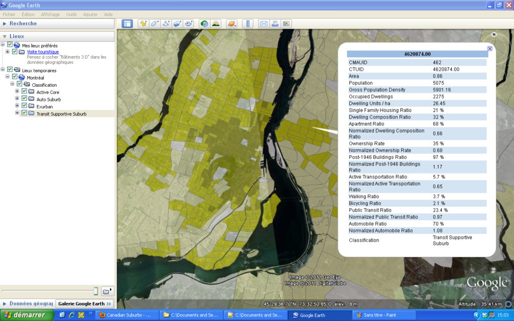
In this screenshot, you can see an aerial view of Montréal. By clicking on some area, you obtain a bubble that gives you a lot of data about this Census Tract such as the Apartment Ratio, the Population, the Area, the Bicycling Ratio…
How to get the Google Earth maps
You will obtain the spreadsheet you want by following these three steps:
- First, click on the province you want on the mini-map below.
- Then, choose the method you want.
- Finally, choose the year when the data were measured.
You can download the one ZIP file for the Density Method here.
You can download one ZIP file for the Transportation Method here.
